


Maple Grove P-22, Hennepin County, Minnesota
About
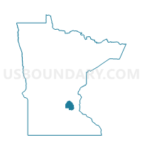
Outline

Summary
| Unique Area Identifier | 602097 |
| Name | Maple Grove P-22 |
| County | Hennepin County |
| State | Minnesota |
| Area (square miles) | 0.94 |
| Land Area (square miles) | 0.93 |
| Water Area (square miles) | 0.01 |
| % of Land Area | 98.93 |
| % of Water Area | 1.07 |
| Latitude of the Internal Point | 45.08184870 |
| Longtitude of the Internal Point | -93.46951970 |
Maps


Graphs
Select a template below for downloading or customizing gragh for Maple Grove P-22, Hennepin County, Minnesota


Neighbors
Neighoring Voting District (by Name) Neighboring Voting District on the Map
- Maple Grove P-17, Hennepin County, MN
- Maple Grove P-18, Hennepin County, MN
- Maple Grove P-21, Hennepin County, MN
- Maple Grove P-23, Hennepin County, MN